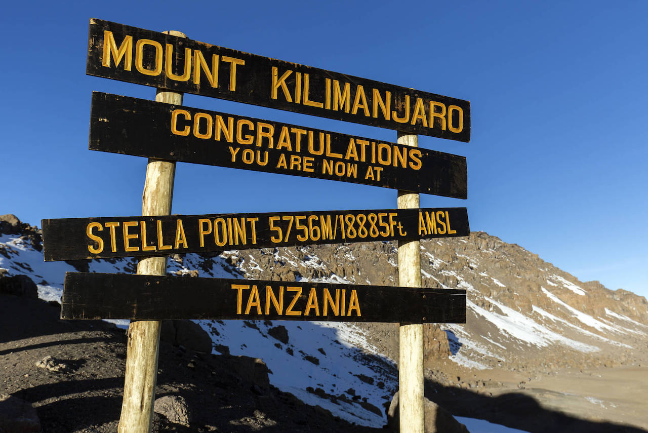
Located at an elevation of 5756 meters (18,885ft) above sea level, Stella Point is part of the three summit points along Mount Kilimanjaro including Uhuru peak (the main peak) and Gilman’s Point. TANAPA put a huge sign at Stella Point which is visible to all hikers and you will find that this will be the last stop before descending while the rest push onto Uhuru Peak. Do not mind about not reaching Uhuru because you will still get your certificate for getting this far and attempting to hike Mount Kilimanjaro.
Stella Point is found on the southern side of the Crater rim of Kibo on Mount Kilimanjaro. Kibo is the tallest of the three peaks on Mount Kilimanjaro that is Shira and Mawenzi. It marks the end of the toughest and roughest hike up Mount Kilimanjaro as the rest of the hike toward Uhuru Peak is simpler.
What is the distance between Stella Point and Uhuru Peak?
It will take you about an hour to get a hike from Stella Point to Uhuru Peak at a distance of 600 ft or 170 m. Remember it is a slow-paced hike to avoid altitude sickness and you might get to the Peak towards or right after dawn.
Climatic zone at Stella Point
Stella Point is located in the arctic zone of Mount Kilimanjaro. The zone does not have any plant or animal life due to the harsh conditions and the only living thing that you might find are spiders. The temperatures are on freeze point sometimes hitting negatives, there is no rainfall, low precipitation, and high winds.
The routes leading to Stella Point
Almost all the hike routes along Mount Kilimanjaro converge around Stella Point before hikers proceed to Uhuru Peak. Note that the hike from Stella Point to Uhuru peak is much easier as compared to the hike from the Barafu Huts to Stella point. The western route is the only one that does not go through Stella Point and since you require a special permit to use it, it is rarely used by hikers.